
DataTerra — Territorial intelligence, from satellite to drone
Sector: Geospatial / Satellite imagery / Drone / SaaS software
Period: 2026 - present
Client: Own project — founder of DataTerra (dataterra.co)
Context
Living in Mexico, I keep seeing the same situation: before buying land, planting a crop or installing solar panels, you need to gather scattered information. Land tenure, satellite imagery, climate, natural hazards, security, access to the power grid: the data exists, often publicly, but it is spread across dozens of sources and hard to cross-reference.
That is how DataTerra was born. After drone market studies in Mexico and Colombia in the first half of 2026, I started development in June 2026. The site has been live since July 2026, in Spanish, English and French, with Latin America as the first market.
Problem
For the decision-maker:
- Investors, developers, agronomists and solar project owners have to assess land, often remotely
- Red flags (ejido land, protected area, flood risk, water stress…) are discovered too late
- A conventional study is slow and expensive for a simple pre-assessment
For the drone operator:
- Operators juggle a dozen tools: CRM, flight planning, weather, airspace, photogrammetry processing, reports, compliance
- Delivering a readable result to the client (maps, 3D, report) still takes a lot of manual work
Solution
DataTerra brings together three complementary offers, from the simplest to the most complete.
1. Geospatial reports scored from 0 to 100
You draw your area (a point or a polygon), pay online, and receive a PDF report with an interactive map. Data from more than 50 sources is cross-referenced and analysed, then summarised by AI into a score and a clear verdict. It is a decision-support tool, not a legal opinion.
- Land & tenure (Mexico) — tenure regime (ejido, communal, private), security, natural hazards, access, environment and protected areas
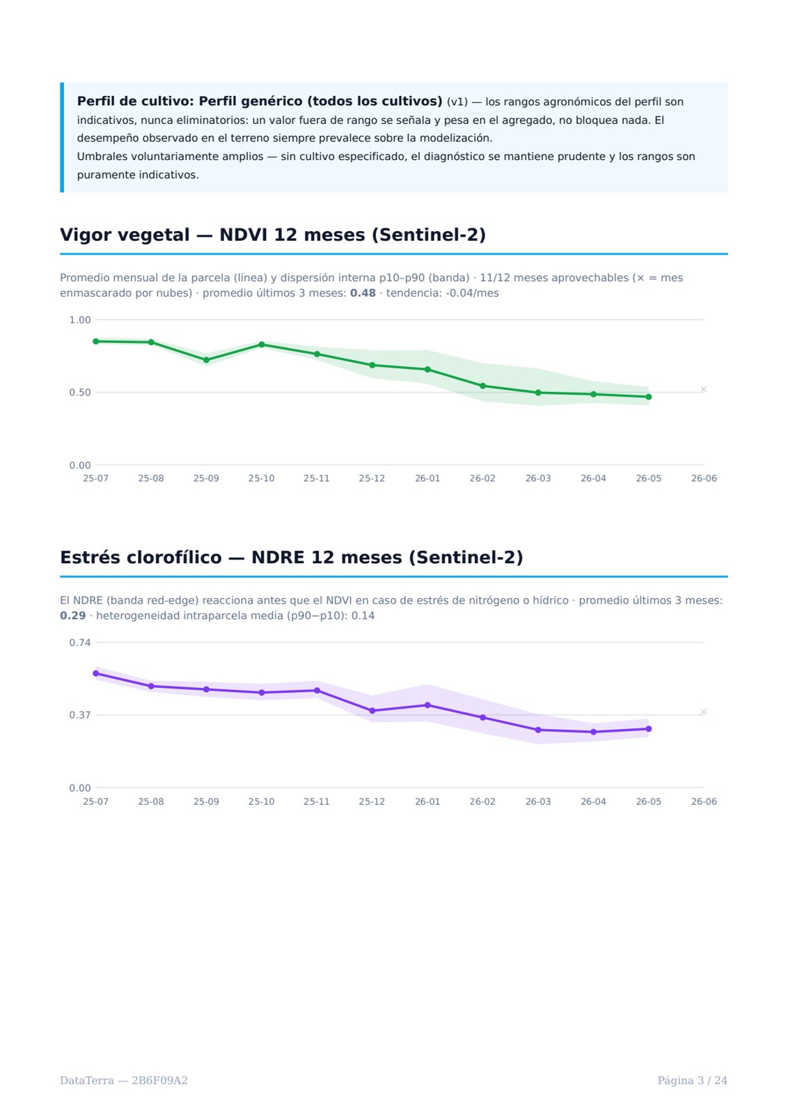
- Agriculture (worldwide) — NDVI/NDRE vegetation vigour measured by Sentinel-2 and its trend, water stress, climate suitability
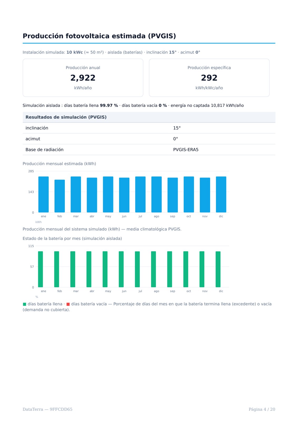
- Solar (worldwide) — irradiance (NASA POWER, Global Solar Atlas), PVGIS production simulation, grid distance, slope, horizon profile
Reports are delivered within 48 hours, from $29. Full samples are available online: see the samples.

2. Drone services, when satellite is not enough
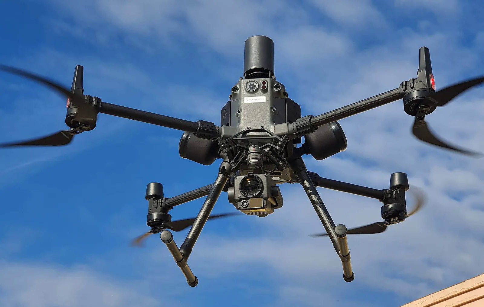
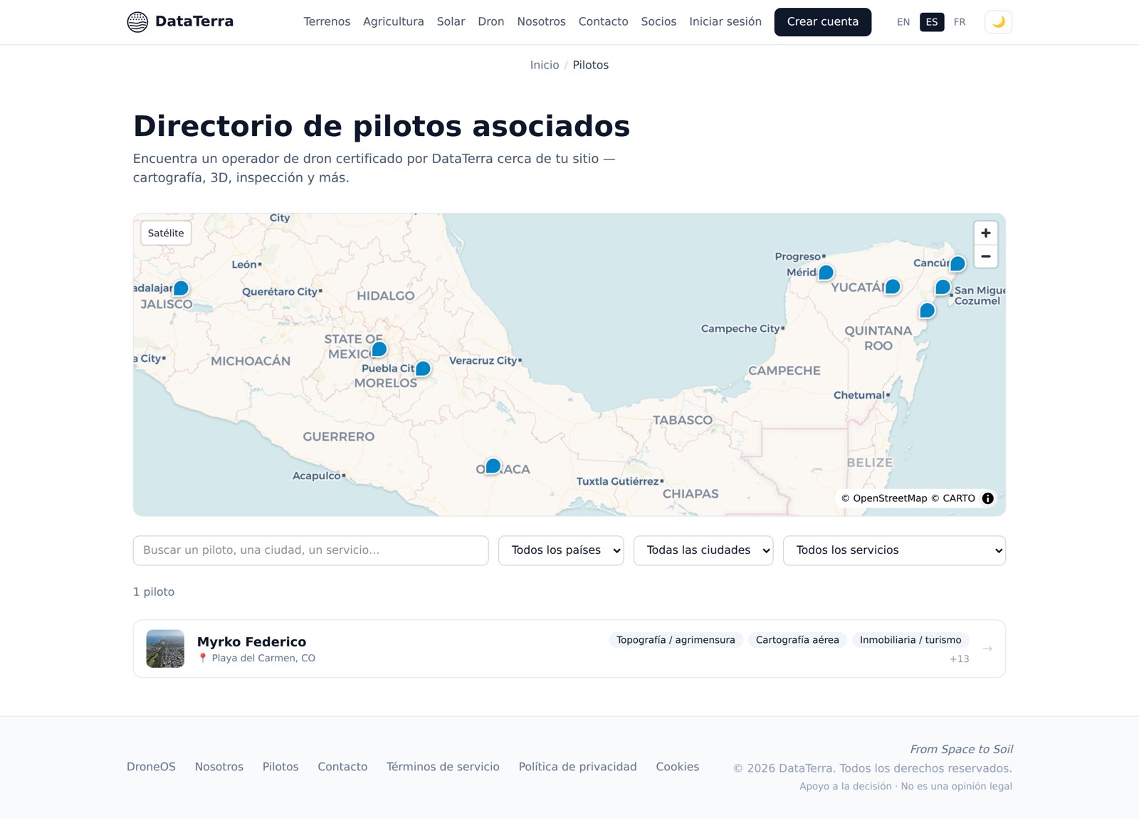
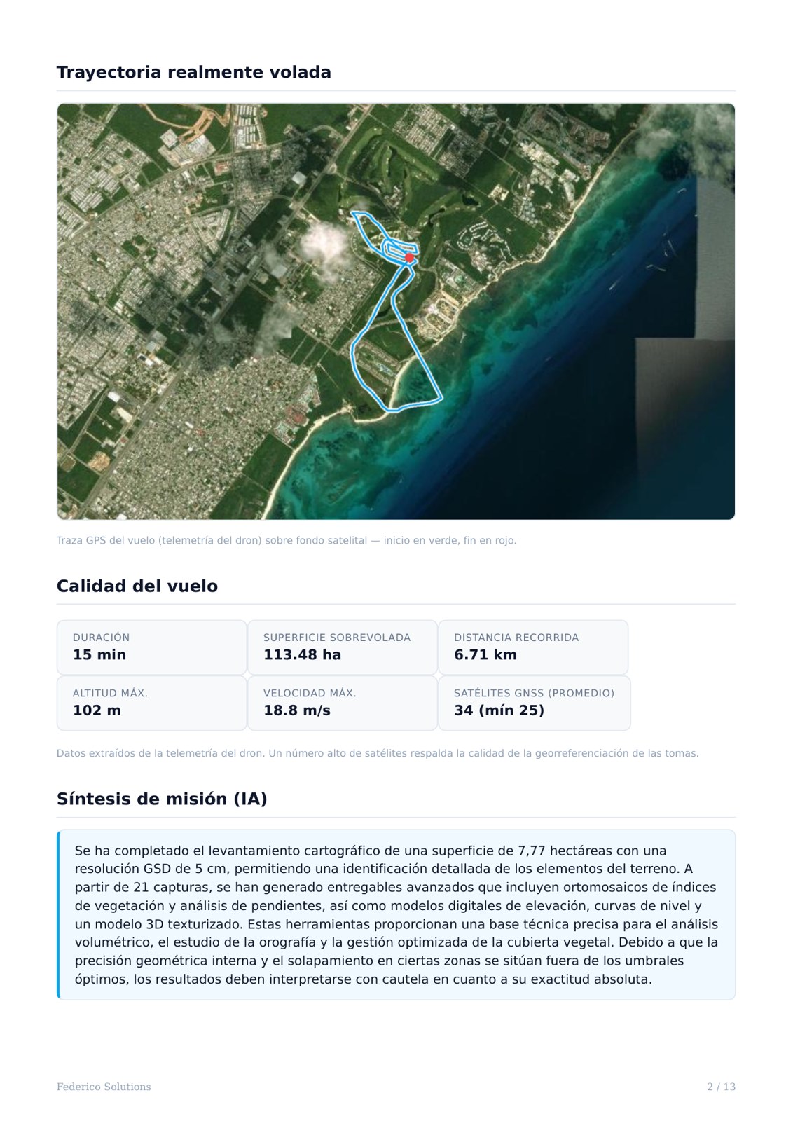
For a much closer look on the ground, DataTerra offers drone missions on quotation: mapping and orthomosaics, photogrammetry and 3D models, inspection and thermography (roofs, solar panels), RTK surveys with ground control points and volume calculation, agricultural multispectral. Deliverables are published in a client portal. A directory of partner pilots lets you find an operator by country, city and service.
3. DataTerra OS, the software for drone operators
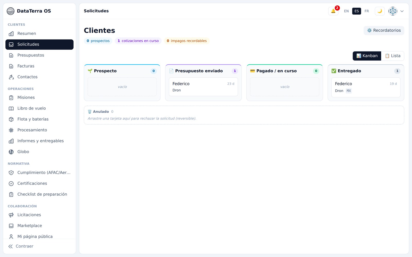
DataTerra OS is the workspace I use myself for my own missions, open to professional operators. It covers the whole chain, from the client request to the deliverable. It is currently in pre-launch, with beta access.
- CRM and sales: request pipeline, PDF quotes and invoices, reminders
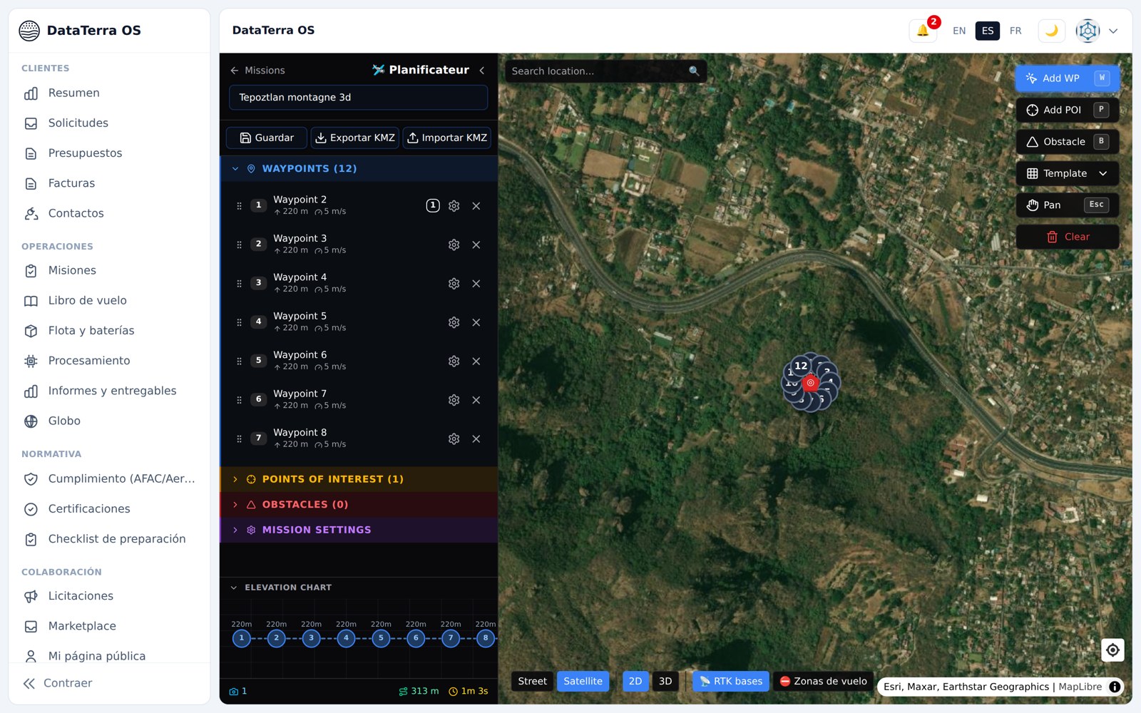
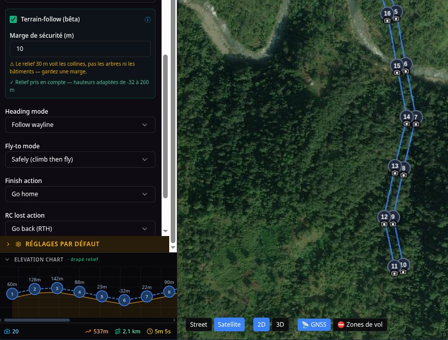
- Flight planning: 8 templates (orbit, grid, façade, corridor, patrol…), a terrain-following mode, export to DJI remote controllers
- PDF flight brief: weather, airspace, RTK bases and nearest public GNSS station, checklist, suggested batteries
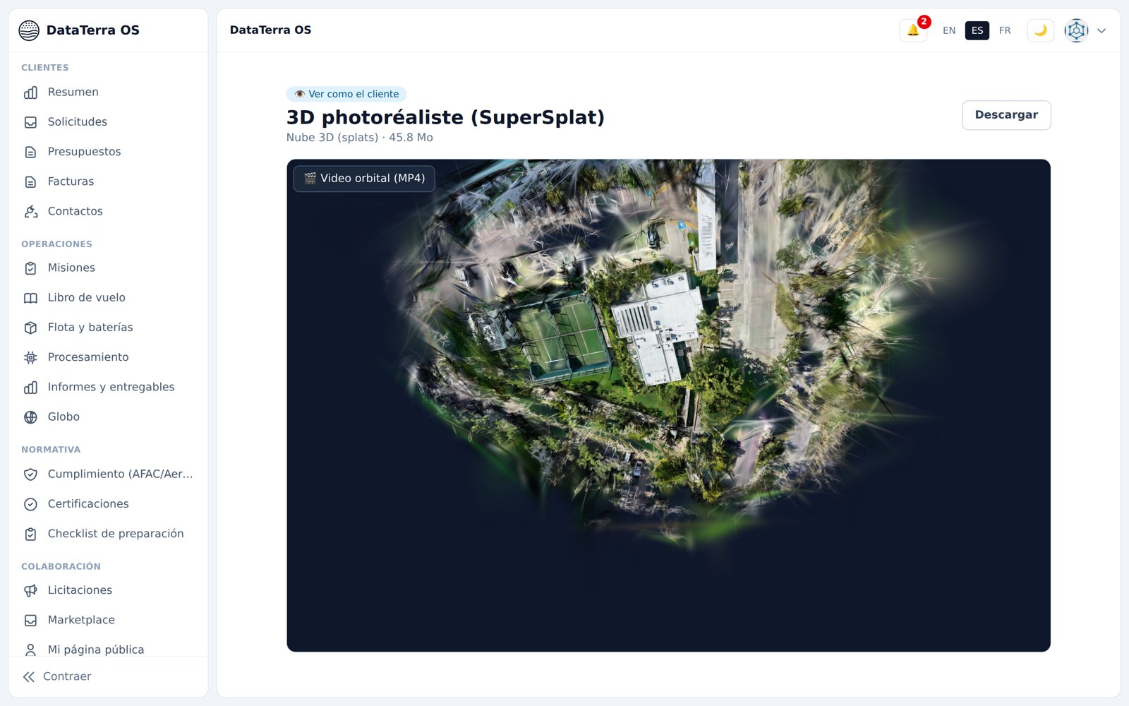
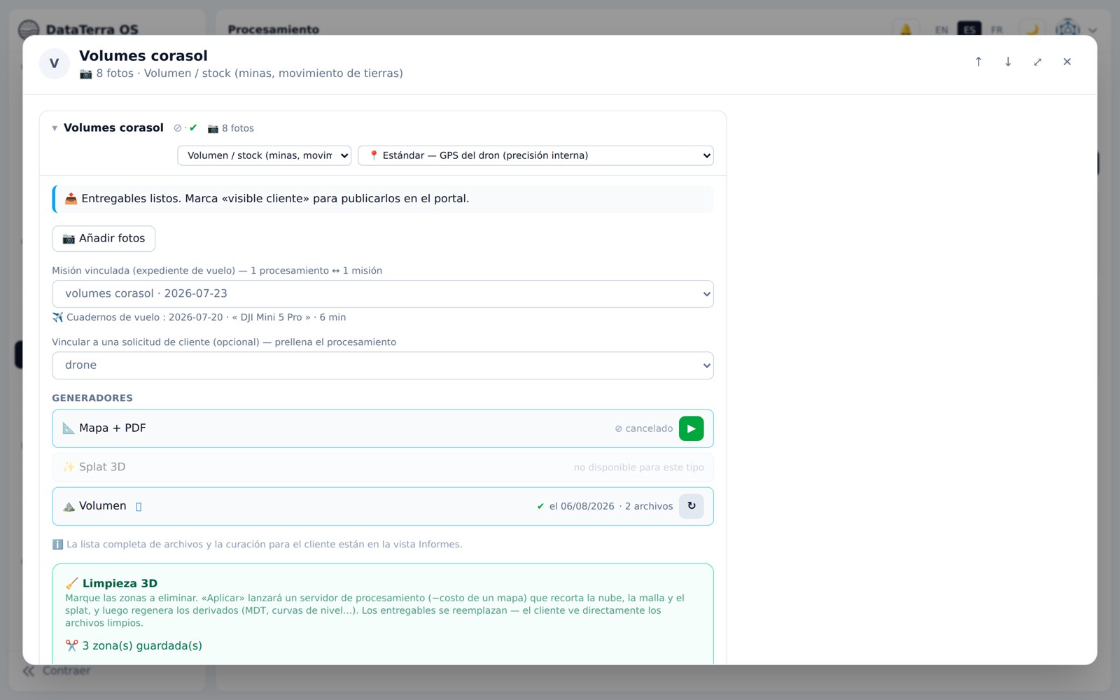
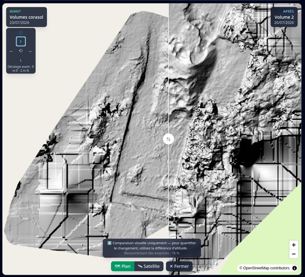
- Cloud processing: orthomosaic, surface model, 3D mesh, photorealistic gaussian splat, volume calculation and tracking between two flights
- Client delivery: final report with AI summary, 2D and 3D viewers, before/after comparison, shared annotations, a portal branded for the operator
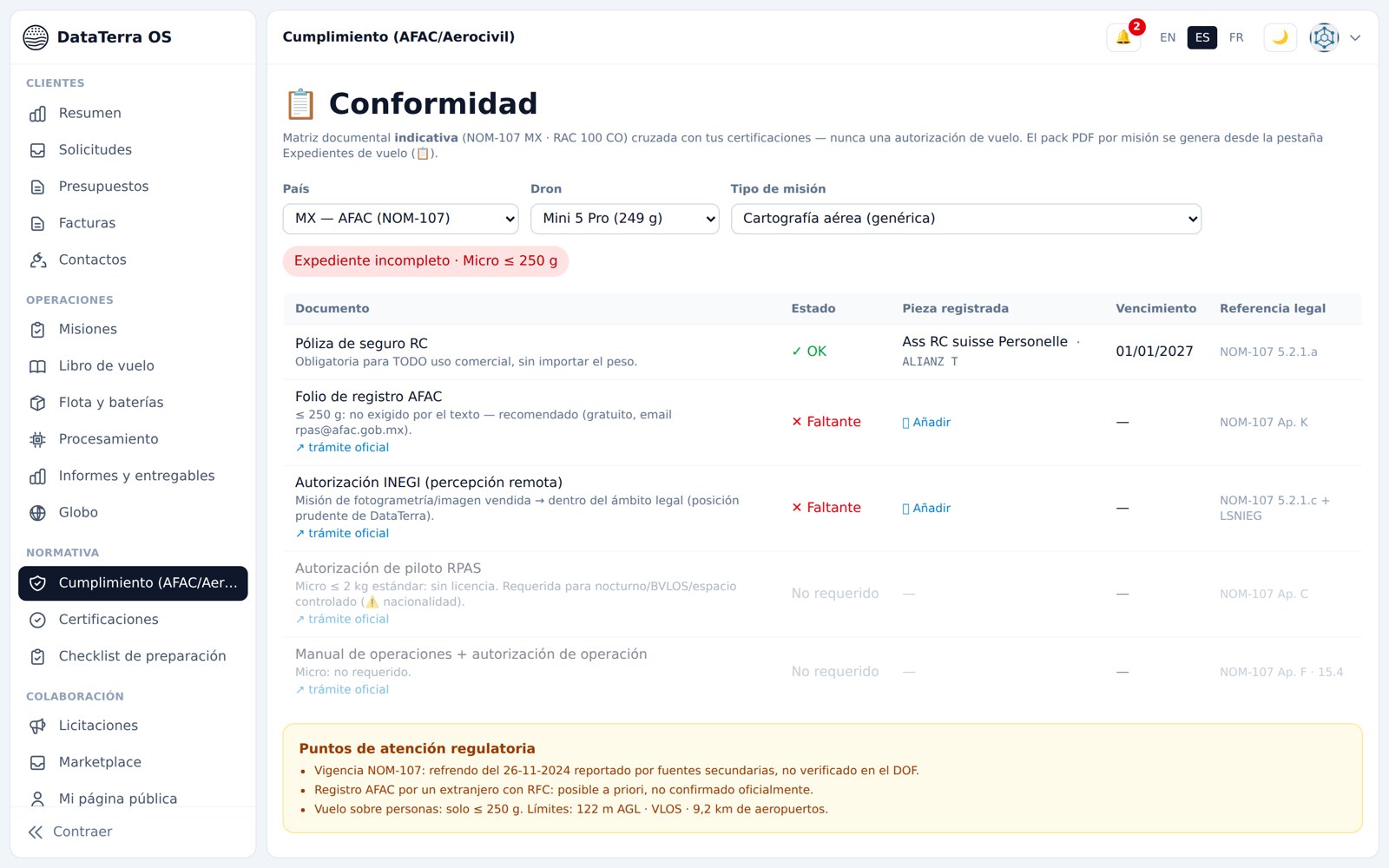
- Operations: automatic flight log from DJI logs, fleet and battery health, Mexico and Colombia compliance, public tender monitoring
Technologies
- Next.js and TypeScript web application, trilingual; PostgreSQL/PostGIS database; Python services
- MapLibre mapping, Cesium 3D globe, Potree point clouds, 3D viewers
- OpenDroneMap and QGIS photogrammetry on on-demand cloud machines
- Open data: Copernicus Sentinel-2, NASA POWER/GIBS/FIRMS, PVGIS, Global Solar Atlas, ERA5, national sources from Mexico and Colombia; 2,131 public GNSS stations catalogued
- AI-written summaries, through a gateway independent of the model provider
- Hosted on Infomaniak's Swiss cloud
Result
Deliverable:
- A platform live in three languages: dataterra.co
- Three geospatial reports that can be ordered online, with public samples: land in Tepoztlán (72.5/100), agriculture in Tepoztlán (71.3/100), solar in Ariguaní, Colombia (82.2/100)
- Drone services on quotation, with a real mission report as a sample: 15 minutes of flight, 7.77 ha, 5 cm/pixel orthophoto
- DataTerra OS in pre-launch, which I use every day for my own missions
This project demonstrates:
- The ability to turn open data (satellite, climate, registries) into readable decisions
- Command of the full drone chain: planning, flight, photogrammetry, 3D, delivery
- Designing a multilingual SaaS product, from idea to launch in a few months
To discover DataTerra: dataterra.co · DataTerra OS · order a report.
Tags: DataTerra, geospatial, satellite, drone, photogrammetry, NDVI, solar, SaaS, Mexico, Colombia